Go west, young man...rerouting...Make a legal U-turn, young man
On Independence Day weekend, I was faced with a fourteen-hour drive and a long outdated, standalone GPS unit. The Garmin Nuvi GPS that I received as a gift two Christmases prior had begun to prompt me to pay for a map update every time I started it up. Consequently, I didn't use it very much, and stuck to using Telenav Navigator or Google Maps on my phone in the frequent instances when I have become truly, hopelessly lost.
As we were packing up the car, I started to wonder just how necessary the Garmin's map update actually would be. I mean, how often do roads really change, right? Presuming the poles of the Earth don't suddenly reverse, an outdated GPS is at least going to give you useful map coordinates and tell you what direction you're driving.
This thought came to mind because we were driving from Baltimore to St. Louis; and as anyone from the area will tell you, the legendarily bad traffic in Los Angeles and Washington, DC faces some stiff competition from STL. Furthermore, to reach my destination, I would be encountering a long term renovation project that fully shuts down different sections of Interstate 64 at various times of the year. In other words, a substantial section of the straightest route from Louisville, Kentucky to Kansas City, Missouri has been in a state of total disruption since December 2008, and I really had no choice but to pick my route around it.
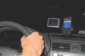
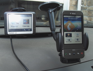
So instead of pre-planning a route, I decided to leave the navigating fully up to the pair personal navigation devices running side-by-side, the standalone unit that was accurate to a date before the major construction, and the trusty mobile phone with its live map data.
There is pretty much only one way to laterally bisect the United States, and that is by taking Route 70. Driving from the Mid-Atlantic to the Midwest is just as simple: you either take Route 70, or you take I-64, any other routes will show you more of the heartland but tack on a lot more time.
View Larger Map
This choice in routes manifests itself as a fork in the highway in the mountains of Maryland: go left and you are on 64, go right and you are on 70. Since the trip on 64 is actually around 30 miles shorter, both navigators told me to go on the left fork, but I went right.
 Expecting both units to reroute for the equally simple trip on route 70, the Garmin repeatedly told me to make a U-turn and get back on 64. Telenav rerouted very quickly, but it took the Garmin unit 32 miles and a handful of exits before it realized what I was doing. It would be a long time before I was presented with another juncture like that.
In the meantime, I ran point of interest (POI) queries on both units: gas stations, restaurants, public parks, and so forth. As one would be silly not to expect, the phone's database of points of interest is infinitely more accurate, more relevant, and faster. The only drawback to Telenav and Google's POI database is that their accessibility is subject to mobile signal availability, and if you're driving in places such as the Great Plains region of the US, a mobile signal is sometimes hard to come by. Fortunately, coverage was strong on my trip.
I wouldn't again get to test either unit's mettle until the Poplar Street Bridge crossing the Illinois border into St. Louis. It was here, where contrary to my expectations, both units pointed me in the wrong direction. I was expecting the old PND to tell me to take I-64, and the current mobile phone GPS to take the detour on I-44. But both units said to take the highway under construction. Considering the construction was a direct obstruction between my location at that moment and my destination, I played along, and took 64 until it ended. Then the familiar rerouting problem took effect, but in full force. I was driving so closely to both navigation units' planned routes that they continually told me to get back on track without providing non-highway alternatives.
In order to switch off the highway directions, I had to drop into the options menus which is a bit hazardous while driving. Okay, hazardous may be an understatement. You know how GPS software always says something to the effect of "do not manipulate while driving" before you start using it? This is why. In Telenav, it requires going back to the home screen, then going to tools & more > preferences > navigations > route style. In Garmin, it requires the user to hit menu > navigation > avoidance. I had to pull over to perform both actions.
Eventually, both devices (and some phone calls to confirm routes) got me on an acceptable path and I reached my destination through a forced avoidance of the highway. What surprised me about this experiment was that the only major strike against the standalone un-connected navigator ended up being its out of date points of interest and its lack of traffic data, which I really had no need to use anyway.
Would I advocate shelling out the cash for a software update for your aging PND? I'd give it a tentative yes, but only if you lack a GPS receiver on your mobile phone, and plan to continue using it a lot.
Updates for Garmin devices cost $70, TomTom costs $79.95, and Magellan updates cost between $79 and $99. Services such as VZ Navigator and AT&T Navigator, on the other hand, are available for $9.99 per month or $2.99 if they're only needed for a 24-hour period.
