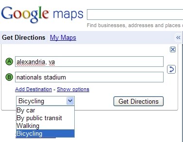
Google Maps now generates bike routes

Different modes of travel often require different routes to be taken. If you're walking somewhere, for example, you're not likely to take a highway to get there, and you have the distinct advantage of being able to go through certain structures that cars cannot. The same goes for biking. When someone is planning to get somewhere by bike, they're going to demand different routes. This is why the Google Maps team today announced that it has added bicycling directions to Google Maps.
Shannon Guymon, product manager for Google Maps said, "We wanted to include as much bike trail data as possible, provide efficient routes, allow riders to customize their trip, make use of bike lanes, calculate rider-friendly routes that avoid big hills and customize the look of the map for cycling to encourage folks to hop on their bikes. So that's exactly what we've done."
Google has taken more than 12,000 miles of bike trail data from the Rails-to-Trails Conservancy's TrailLink.com database. The Washington, DC nonprofit has been collecting trail data since 2000, and has maps, pictures, descriptions, and listings for more than 30,000 miles of bike trails.
"The demand for trail maps and information has never been higher, especially as more people recognize biking as a viable, inexpensive and healthy alternative to driving," said Rails-to-Trails President Keith Laughlin today.
But simply having the data on hand is completely a different matter from the whole business of machine-suggested routes. Google had to incorporate trail data into its routing algorithm, include metropolitan areas with designated bike lanes, and include roads that have been recommended by other cyclists, all the while taking into consideration the business about certain roads. All that is just to determine the most biker-accommodating paths according to safety. There's also the whole issue of hills.
"Our biking directions are based on a physical model of the amount of power your body has to exert given the slope of the road you're biking on," said Google software engineer John Leen. "Assuming typical values for mass and for wind resistance, we compute the effort you'll require and the speed you'll achieve while going uphill. We take this speed into account when determining the time estimate for your journey, and we also try hard to avoid routes that will require an unreasonable degree of exertion." Likewise, the algorithm avoids routes that have too much downhill travel as well so the ride is balanced.
Today's launch of Google Maps for bikes is sort of the opposite of a development from last year, an Android app called My Tracks which targeted runners, hikers, and cyclists. Instead of suggesting routes, My Tracks collected live GPS statistics from the user's smartphone and mapped out total/moving time, (average) speed, distance, and elevation profile on Google Maps as the trips were being made.
Google Maps for bicycles is live right now.
